Data Conversion
Iteac provides services for the conversion of hard copy data into a digital GIS format, including edge matching and clean up services.

Iteac provides Data Conversion Services.
We have a range of services which includes data capture, map publishing, GIS database development and complete solutions in data conversion, data analysis, and data presentation. We are equipped with the state-of-the-art conversion facilities and skilled professionals and offer data conversion services using Microstation, ArcInfo, AutoCAD and CAD Overlay. GIS Data Conversion Process of Water Distribution Network Currently, majority of the water mapping data updated in paper format. Converting from paper to digital geospatial data was a major component of and the foundation for the PWP Enterprise GIS.
The goal of the implementation of the GIS program is to facilitate the timely and accurate capture, documentation, and distribution of network asset information to the entire PWP workforce. This will enable to improve customer service, and meet competitive challenges. A GIS will allow Pasadena Water and Power to better manage, plan, and model its water system and resources.
The data Conversion Services provided by us are :
Pre-conversion map updating.
Manual digitizing and data input.
Edge matching.
Polygon building and analysis.
Linear and area measurements.

Data Conversion
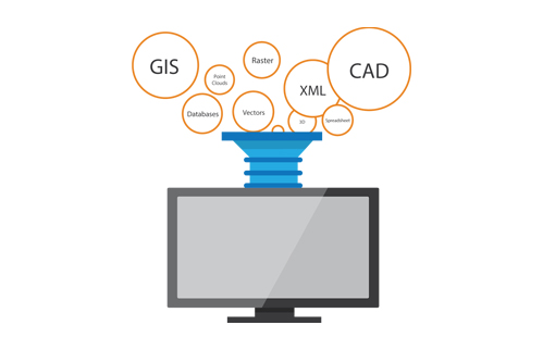
Data conversion is the process of transforming graphic and non-graphic analog sources into a computer-readable format through data input and/or transforming existing spatial digital data into a format that can be used by a Geographic Information System (GIS). This fact sheet refers to only the conversion of existing digital data.
Spatial data include data that is geographically referenced, and digital data is data which is represented in computer-readable format. Two types of digital data exist: raster and vector data. Raster data is computer-readable data that represents values stored for maps or images and organized sequentially by rows and columns. Vector data is also computer-readable but, it is a coordinate-based data structure commonly used to represent map features. Each linear feature is represented as a list of ordered x,y coordinates. Raster data may be converted to vector data or vice-a-versa. Some GIS’s are able to automate both vector and raster data digital data. Other systems require one digital data type or the other.
Data conversion is prevalent due to widespread increase of data exchange among organizations due to the increase of participants of network communications, the ever growing availability of GIS platforms, and the expense of creating a digital spatial database. Data development is the most component of a GIS so data exchange helps to ease the cost, plus at the same time eliminate duplicate work. Why create spatial data in-house when some other organization has compiled that data and that data is accessible.
